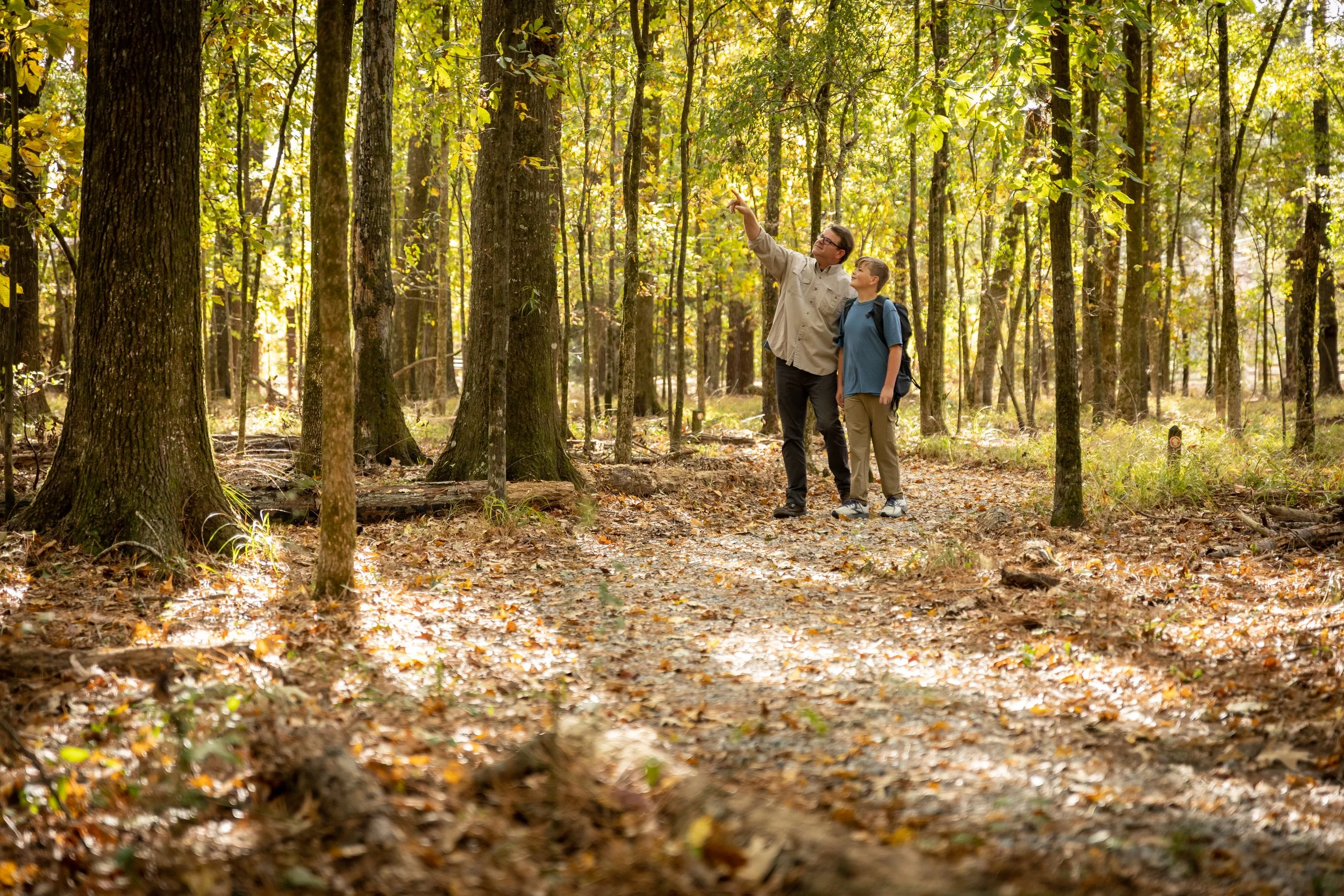
Choose Your Adventure
Waterfalls, coastal bayous, hardwood forests, scenic rivers, and miles of trails — explore the natural destinations that make Mississippi unforgettable.
EXPLORE THE TRAIL
The Great Mississippi Nature Trail includes a curated list of sites across the state. Each location is organized by ownership and purpose to help you discover Mississippi’s rich ecological and cultural landscapes.


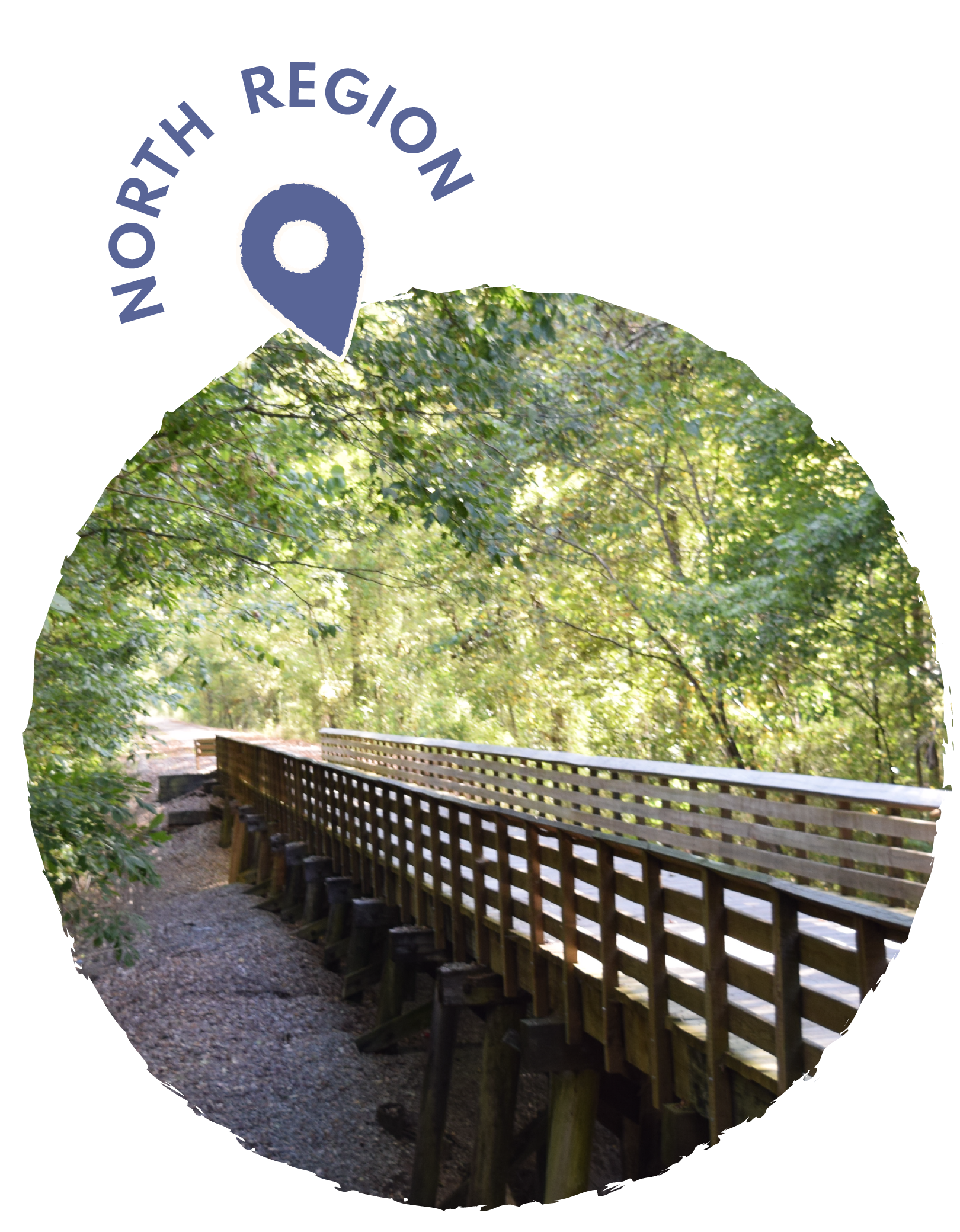
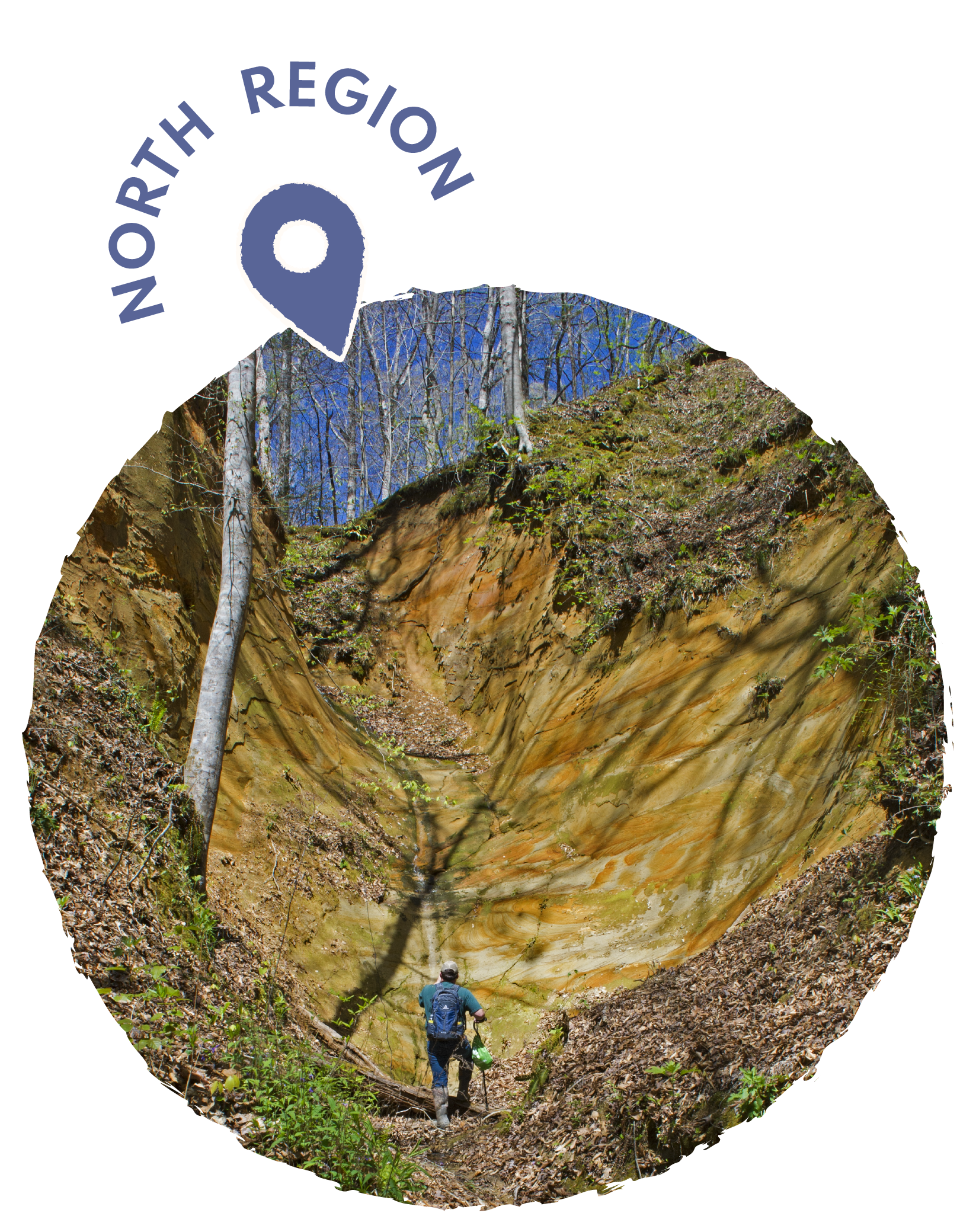
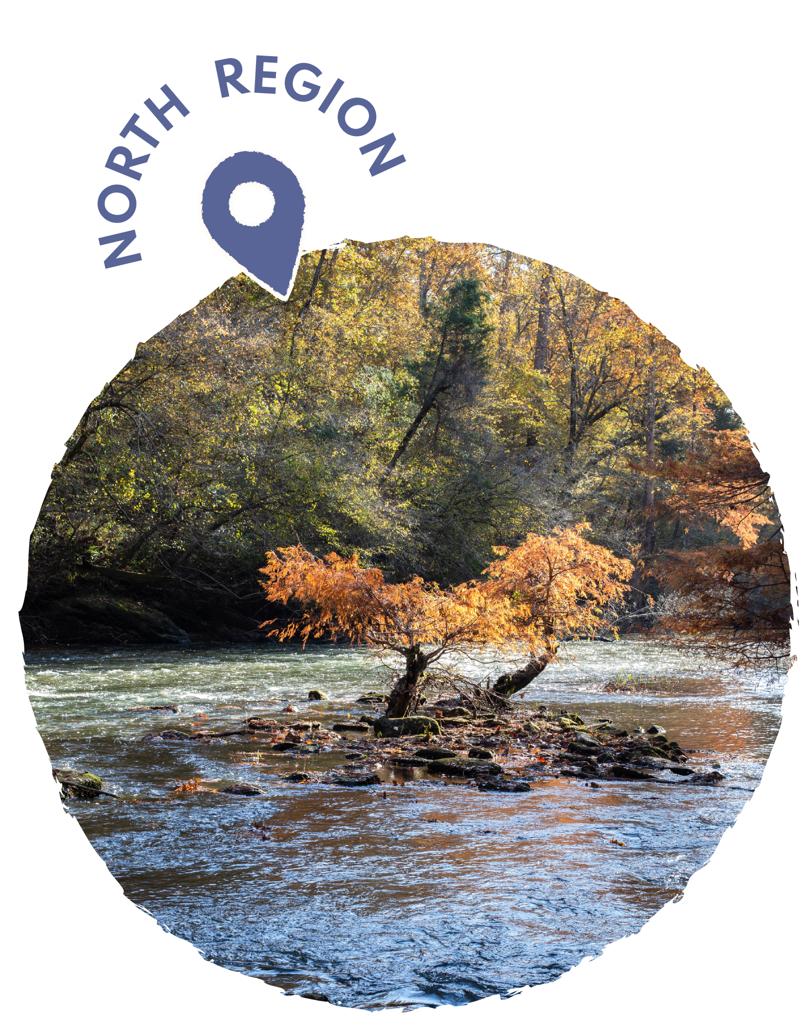
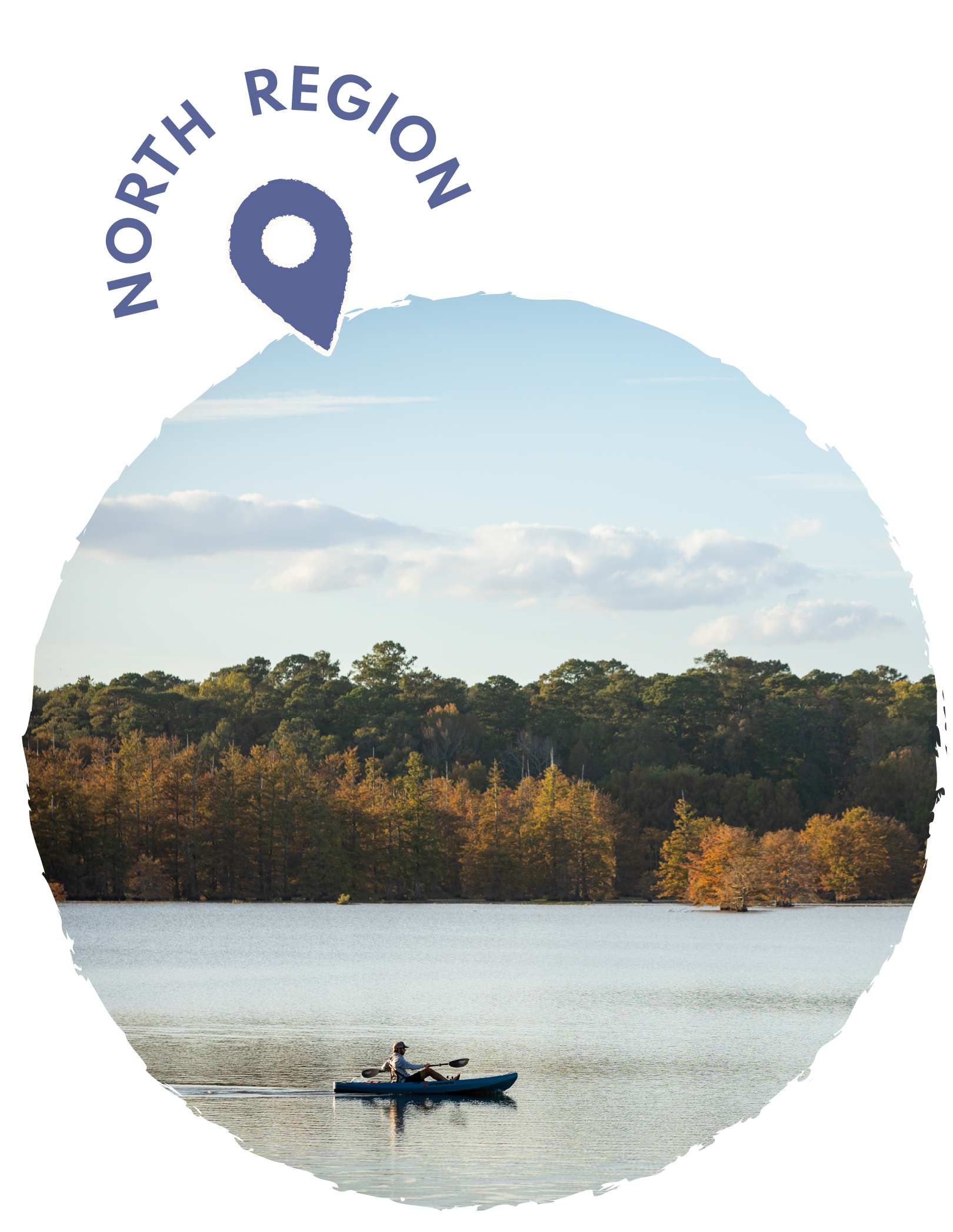
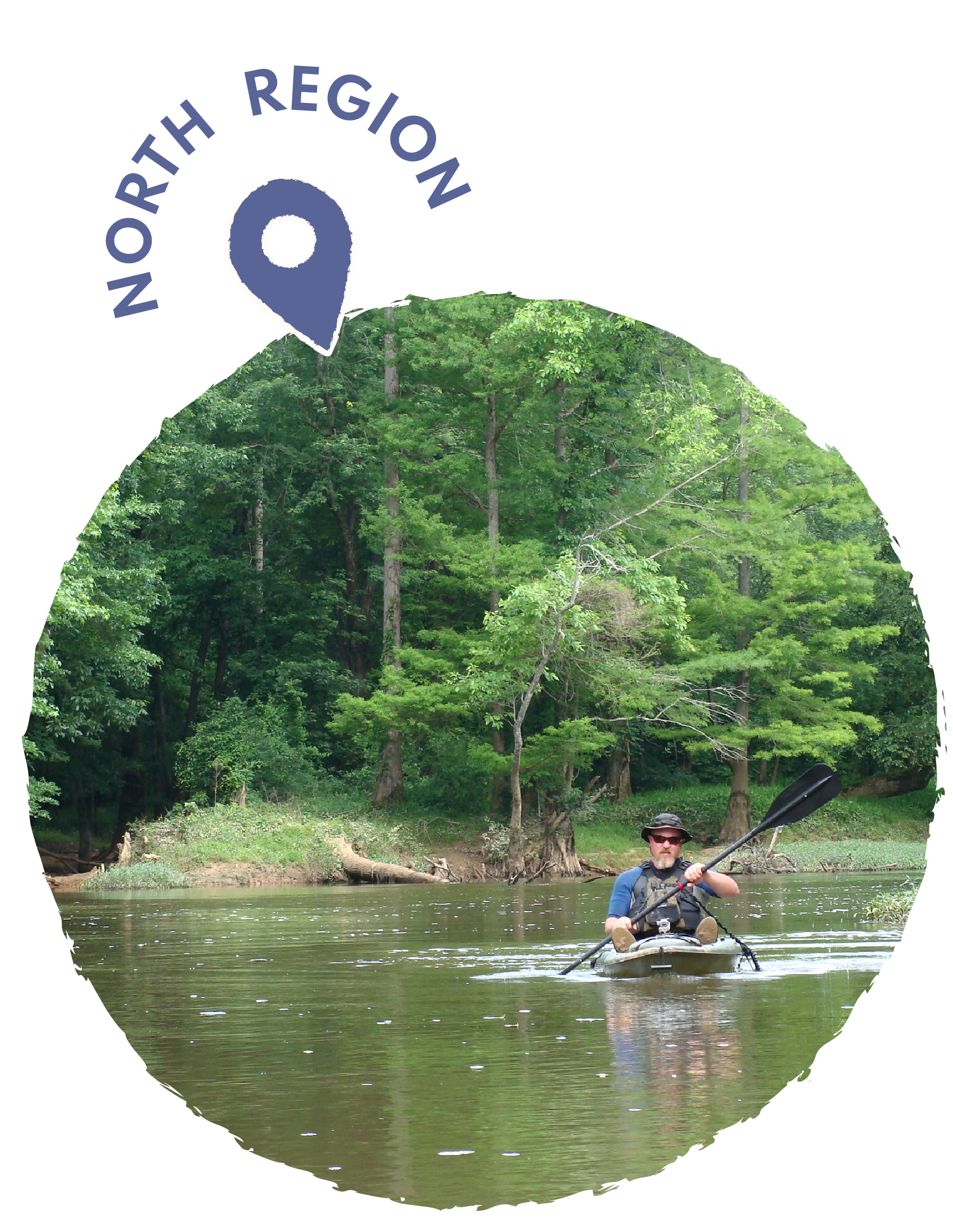
NORTH REGION
-
The Tanglefoot Trail winds its way through the picturesque countryside of northeast Mississippi, following the historic route of the Gulf, Mobile & Ohio Railroad built by Colonel William C. Falkner, great-grandfather of Nobel Prize-winning author William Faulkner. Stretching approximately 43.6 miles from Houston to New Albany, this premier rail-trail passes through charming small towns including Pontotoc, Algoma, and Ecru, offering visitors a glimpse into the region's rich cultural heritage. The trail's smooth, paved surface makes it ideal for cyclists, joggers, and hikers of all skill levels, while its well-maintained facilities provide convenient rest areas along the journey. Surrounded by native wildflowers, hardwood forests, and wetlands, nature enthusiasts can observe diverse wildlife and seasonal flora. The Tanglefoot Trail derives its unique name from the legendary Tanglefoot locomotive that once struggled to climb the steep grades in the area, often becoming "tangled" on the tracks. Visitors can explore the trail's numerous historical markers that detail the region's railroad history, Civil War significance, and Chickasaw Native American heritage. Whether enjoying a short afternoon excursion or a multi-day adventure, the Tanglefoot Trail offers an immersive experience through some of Mississippi's most beautiful and historically significant landscapes.
GPS COORDINATES: 34.254219° N, -89.010827° W
-
The Old Cove in Webster County, Mississippi, stands as a picturesque reminder of the region's natural splendor, nestled among the rolling hills of north-central Mississippi. This hidden gem features lush woodlands that transform dramatically with each season, from vibrant springtime blooms to the rich amber hues of autumn. Visitors to The Old Cove can explore miles of well-maintained trails that wind through diverse ecosystems, offering glimpses of native wildlife and rare plant species that thrive in this protected area. The area holds significant historical value, having served as an important settlement for early pioneers who were drawn to its fertile soil and abundant natural resources. Local conservation efforts have helped preserve the pristine beauty of The Old Cove, ensuring that future generations can continue to enjoy its tranquil atmosphere and ecological diversity. Community events held throughout the year celebrate the area's cultural heritage, bringing together residents and tourists alike for festivals that showcase traditional crafts, music, and cuisine. The Old Cove welcomes nature enthusiasts, photographers, hikers, and anyone seeking a peaceful retreat from the bustle of everyday life.
GPS COORDINATES: 38.38° N, -90.88° W

-
Lee Tartt Nature Preserve is a 300-acre wild oasis just minutes from downtown Grenada, where protected bottomland hardwood forests surround Chakchiuma Swamp—a cypress-tupelo wetland formed from ancient oxbow lakes once connected to the Yalobusha River. Visitors can explore easy walking trails, watch abundant wildlife, paddle through calm waters, or simply enjoy the quiet beauty that defines this uniquely Mississippi destination. Open from dawn to dusk, the preserve welcomes families, hikers, birdwatchers, artists, and anyone seeking to experience the rich biodiversity of North Mississippi. Three trail systems offer options for all skill and mobility levels: the 2.5-mile Bottomland Trail features a smooth, wide path with labeled native trees and views of rivers, lakes, and mature forest; the 1.5-mile Swamp Trail follows gravel and former logging roads to boardwalks, overlooks, and kayak launches with sweeping swamp and river views; and the 0.25-mile Old Forest Trail provides an intimate footpath beneath mature hardwoods along the northernmost oxbow. Together, these trails offer a welcoming gateway into landscapes restored and cared for by Friends of Chakchiuma Swamp, the nonprofit dedicated to stewardship, education, and community connection at the preserve. Learn more at friends-of-cs.org.
GPS COORDINATES: 33°47'37" N, 89°48'42" W
-
Tishomingo State Park, located in northeastern Mississippi near the Alabama border, is one of the state's most scenic natural destinations. The park sits atop the foothills of the Appalachian Mountains, offering visitors a unique landscape of massive rock formations, bluffs, and dense hardwood forests that are uncommon in the typically flat Mississippi terrain. Named after a famous Chickasaw chief, the park features the swamp cypress-lined Bear Creek, which provides excellent opportunities for canoeing, fishing, and swimming. Hiking enthusiasts can explore several trails that wind through the rugged terrain, including paths that lead to dramatic rock outcroppings and overlooks. The park offers both primitive and improved camping facilities, along with cabins for those seeking more comfortable accommodations. Rock climbing and bouldering are popular activities due to the park's distinctive sandstone formations. Wildlife viewing is abundant, with opportunities to spot deer, wild turkeys, and various bird species throughout the forested areas. The park also features picnic areas and a disc golf course for additional recreational activities.
GPS COORDINATES: 34.6047° N, 88.1909° W
-
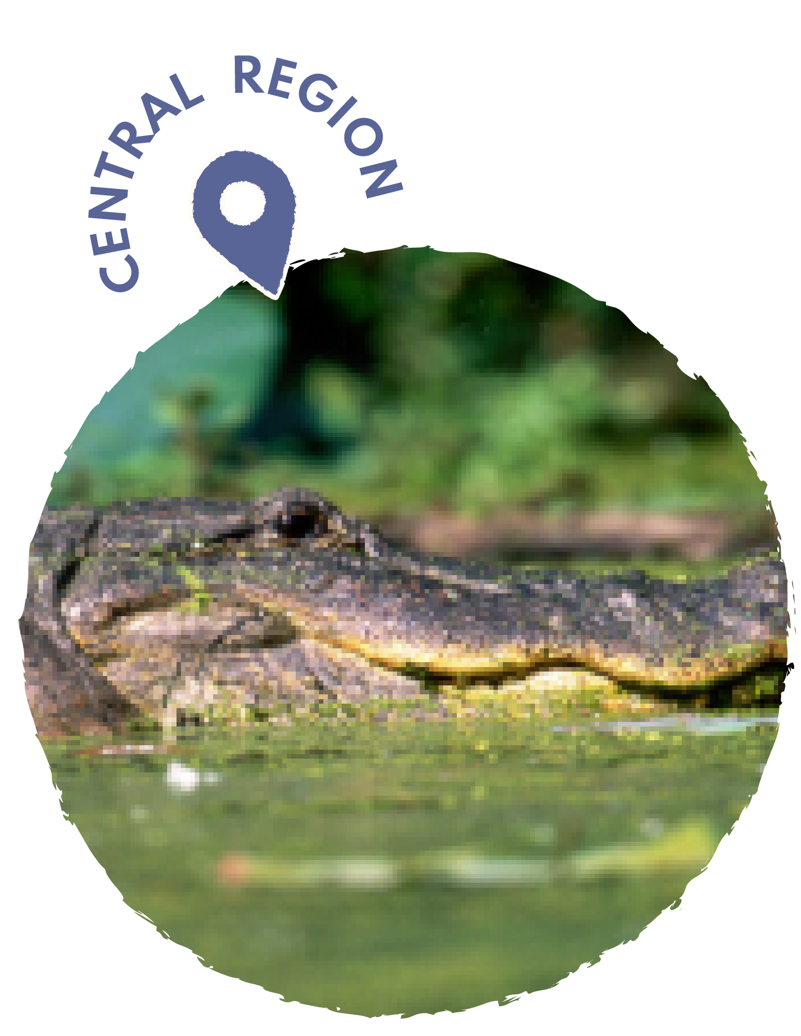
The Sam D. Hamilton Noxubee National Wildlife Refuge spans 48,000 acres in east-central Mississippi, serving as a critical habitat for migratory waterfowl and other wildlife species. Established in 1940 and later renamed to honor conservationist Sam D. Hamilton, the refuge encompasses diverse ecosystems including bottomland hardwood forests, pine uplands, prairie grasslands, and numerous wetlands. The refuge provides essential wintering habitat for thousands of ducks and geese along the Mississippi Flyway, while also supporting year-round populations of wild turkeys, white-tailed deer, and over 200 bird species. Visitors can enjoy wildlife observation, photography, hunting, and fishing opportunities throughout the refuge's varied landscapes. The refuge features several hiking trails, including the popular Boardwalk Trail that offers excellent wildlife viewing from elevated platforms over cypress swamps. Educational programs and guided tours help visitors learn about wetland conservation and the important role these habitats play in supporting biodiversity. The refuge's management practices include prescribed burning, water level manipulation, and forest management to maintain optimal conditions for wildlife. Conservation efforts here also benefit threatened and endangered species such as the wood duck and various neotropical migratory birds.
GPS COORDINATES:
-
The Buttahatchie River is a remarkably diverse and largely unaltered waterway that winds 124 miles from its rocky headwaters in Alabama to its confluence with the Tennessee-Tombigbee Waterway in Mississippi. Meaning “pretty river” in Chickasaw, it supports a wide array of wildlife, including six federally threatened or endangered mussel species, rare fish like the Gulf strain of walleye and frecklebelly madtom, and numerous other at-risk species. Its natural beauty and steady current make it a favorite for kayakers, canoeists, and anglers—especially those seeking its well-known catfish. Although the river faces pressures from gravel mining, habitat loss and development, it remains one of the last un-channelized streams in the Southeast and an ecologically vital system that continues to sustain wildlife, support recreation and reveal deep archaeological ties to Native American history.
GPS COORDINATES: 33°39′2″N, 88°30′49″W
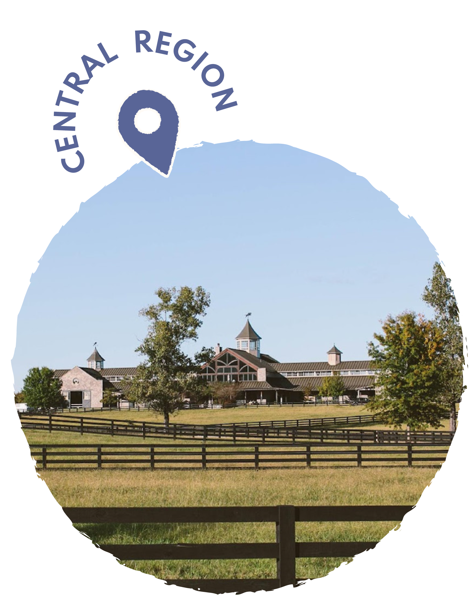
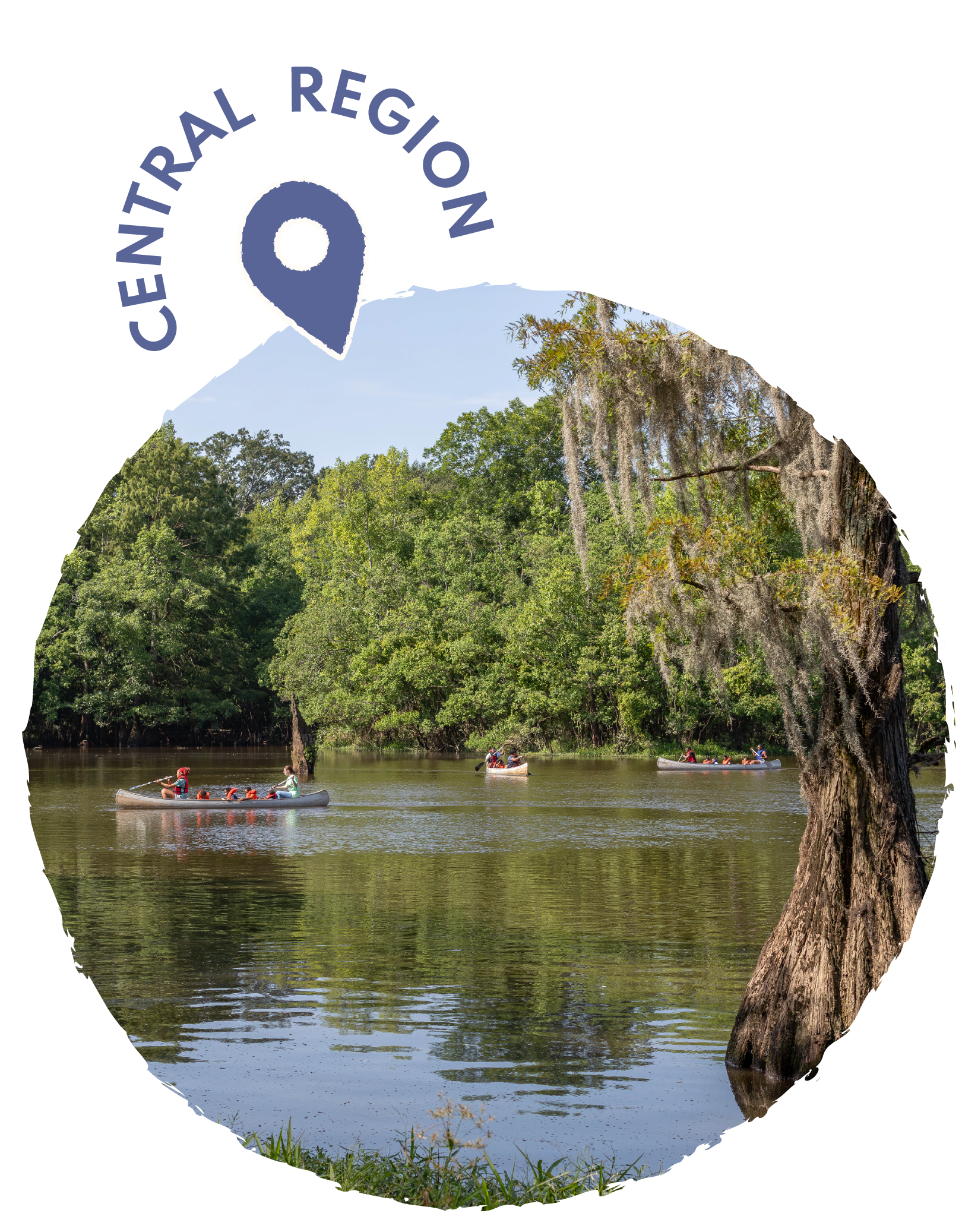
CENTRAL REGION
-
Providence Hill Farm is a 1,250-acre private retreat set among the rolling hills of central Mississippi, offering a refined and expansive setting for outdoor sporting. Originally created as a family getaway, the property now features top-tier facilities for shooting, fishing, and equestrian activities. Its premier sporting clay range includes 14 stations that simulate a variety of game, along with a duck-flush course over water and a modern five-stand range, supplemented by full skeet and trap fields, an 800-yard rifle range, and a dedicated pistol range. Archers can enjoy a 24-target 3-D course woven through the landscape, while anglers have access to three bass lakes stocked more than a decade ago and known for producing impressive 12–14-pound catches, plus a catfish pond popular with younger visitors. The estate’s equestrian complex—featuring a 36-stall stone stable, covered arena, and outdoor all-weather arenas—supports high-level hunter/jumper training, with horses competing successfully at major shows across the country.
GPS COORDINATES: 32.4675° N, 90.3765° W
-
LeFleur's Bluff State Park is a scenic 305-acre park located in Jackson, Mississippi, situated along the Pearl River. The park offers visitors a peaceful retreat from urban life with its diverse recreational opportunities, including hiking trails that wind through hardwood forests and along the riverbank. Fishing enthusiasts can enjoy angling for bass, bream, and catfish in the Pearl River, while the park's boat launch provides easy water access. The park features a well-maintained campground with both RV sites and primitive camping areas, making it popular for overnight stays. Nature lovers can explore the park's interpretive trails and observe local wildlife, including various bird species and native plants. The park also houses the Mississippi Museum of Natural Science, which adds an educational component to visits with exhibits on the state's natural history and ecosystems. Picnic areas and playgrounds make it an ideal destination for families, while the park's proximity to downtown Jackson offers convenient access to urban amenities. LeFleur's Bluff serves as an important green space for the capital city, providing residents and tourists alike with opportunities for outdoor recreation and environmental education.
GPS COORDINATES: 32°19′47″N 90°08′54″W
-
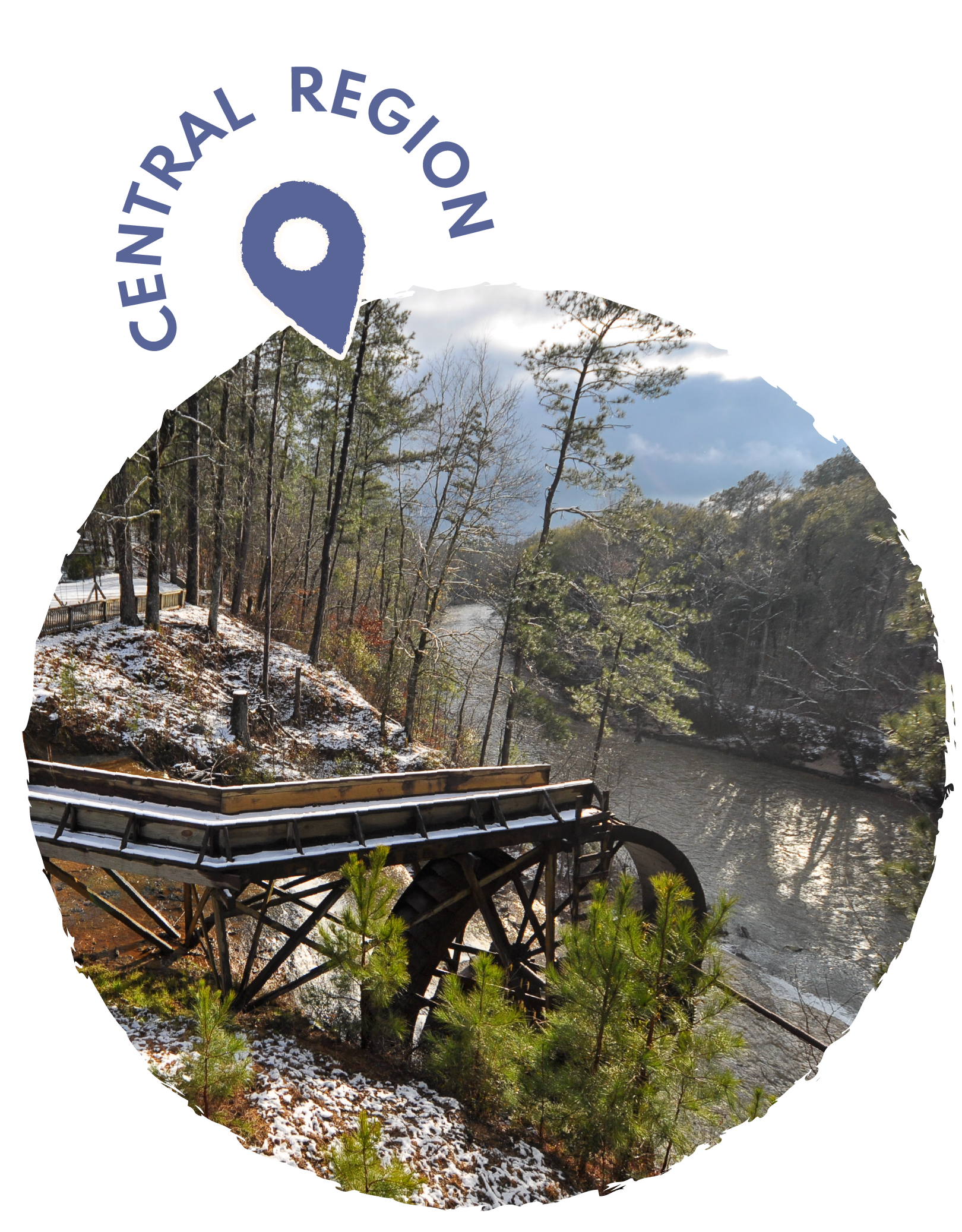
Dunn’s Falls in Enterprise, Mississippi, is a striking blend of natural beauty and human ingenuity. In the mid-1800s, Irish immigrant John Dunn dammed a nearby stream to power a cotton mill, creating a spectacular 65-foot waterfall that later became a vital grist mill for local farmers. The site bustled with activity through the early 1900s before the original mill fell into disrepair; the current historic mill, relocated from Georgia in 1987, now stands in its place. Today, Dunn’s Falls Water Park offers visitors scenic river views, family-friendly floating trips on the Chunky River, excellent fishing, and a variety of outdoor activities across its 69 acres. Just off Interstate 59, it remains a place where history, recreation and natural wonder come together.
GPS COORDINATES: 32.2287° N, 88.8213° W
-
Yazoo National Wildlife Refuge, established in 1936, encompasses over 12,000 acres of diverse wetland habitats in the heart of Mississippi's Delta region. Located along the Mississippi River floodplain, the refuge serves as a critical stopover point for migratory waterfowl traveling the Mississippi Flyway, hosting thousands of ducks, geese, and other waterbirds during peak migration seasons. The refuge features a mosaic of bottomland hardwood forests, cypress swamps, and managed wetlands that provide essential breeding and feeding grounds for over 200 bird species. Visitors can explore the refuge through driving tours, hiking trails, and wildlife observation platforms that offer excellent opportunities for birdwatching, photography, and environmental education. The refuge also supports populations of white-tailed deer, wild turkey, alligators, and various fish species in its oxbow lakes and sloughs. Beyond wildlife habitat, Yazoo National Wildlife Refuge plays an important role in flood control and water quality improvement for the surrounding agricultural region. The refuge offers seasonal hunting opportunities for waterfowl and deer, contributing to wildlife management and outdoor recreation in Mississippi. Educational programs and partnerships with local schools help promote conservation awareness and environmental stewardship among visitors of all ages.
GPS COORDINATES: 32.2287° N, 88.8213° W
-
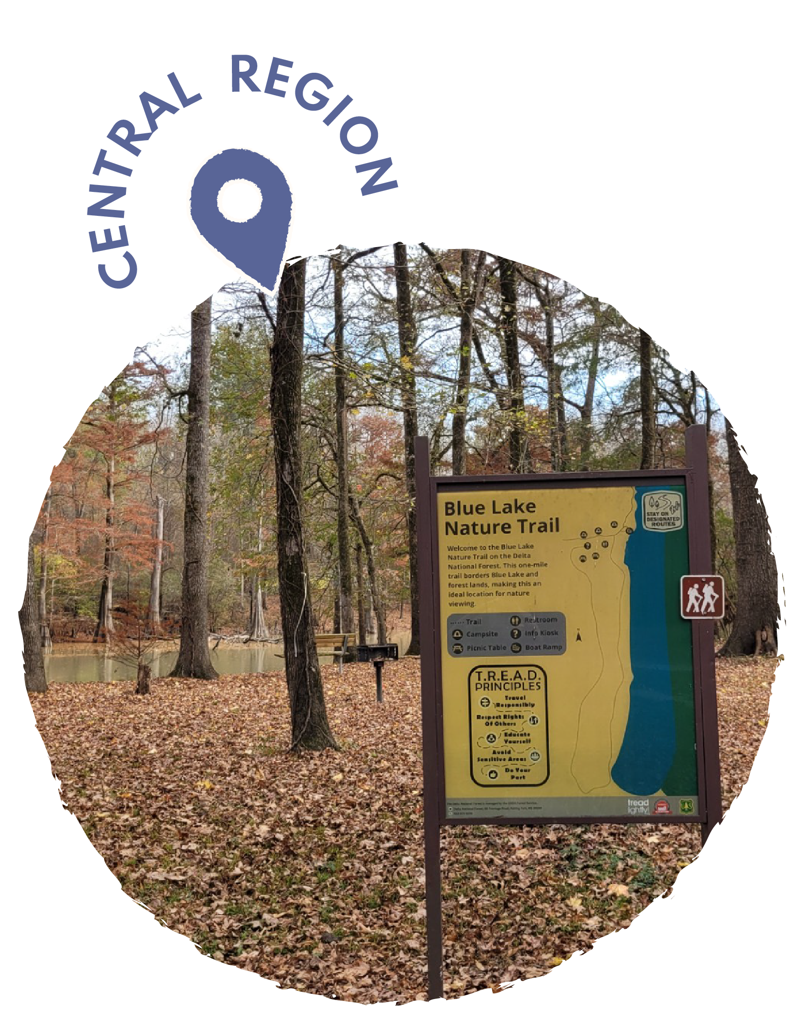
Delta National Forest is located in the heart of the Mississippi Delta region, covering approximately 60,000 acres across Sharkey and Washington counties in west-central Mississippi. Established in 1961, it was created primarily to demonstrate that forests could be successfully grown on former agricultural lands in the Mississippi River floodplain. The forest is unique among national forests because it was developed on land that was previously farmed, consisting mainly of fertile alluvial soils deposited by centuries of river flooding. Today, it features a mix of hardwood bottomland forests, including oak, ash, elm, and cottonwood trees, along with some planted pine stands. The forest provides important habitat for wildlife such as white-tailed deer, wild turkey, waterfowl, and various songbird species. Recreational opportunities include hunting, fishing, hiking, and wildlife observation, with several primitive camping areas available for visitors. The forest also serves important ecological functions, including flood control, water quality improvement, and carbon sequestration. Delta National Forest plays a crucial role in demonstrating sustainable forestry practices and serves as a living laboratory for forest management techniques in bottomland hardwood ecosystems.
GPS COORDINATES: 32.7608° N, 90.7913° W
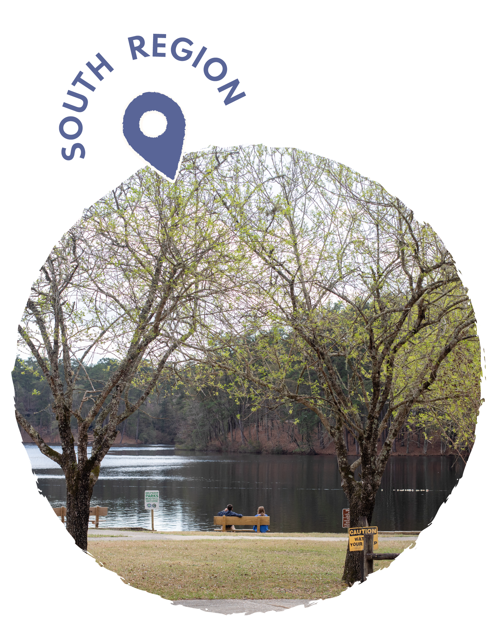
SOUTH REGION

-
The Natchez Trace Parkway is a 444-mile scenic highway that follows the historic Natchez Trace, an ancient travel corridor used by Native Americans, European settlers, and early American traders and soldiers. The parkway stretches from Natchez, Mississippi, to just south of Nashville, Tennessee, passing through Mississippi, Alabama, and Tennessee. Originally established as a National Parkway in 1938, it preserves and interprets the rich cultural and natural history of the Old Southwest. The route offers visitors numerous opportunities to explore historic sites, including Native American mounds, Civil War battlefields, and remnants of old settlements and stands that once served weary travelers. The parkway features beautiful landscapes of forests, meadows, and waterways, making it popular for scenic drives, hiking, biking, and horseback riding. Visitors can stop at the Natchez Trace Parkway Visitor Center near Tupelo, Mississippi, to learn about the area's history through exhibits and films. The parkway also provides access to numerous trails, picnic areas, and campgrounds for outdoor recreation. With its speed limit of 50 mph and prohibition of commercial traffic, the Natchez Trace Parkway offers a peaceful alternative to interstate travel while connecting travelers to America's frontier heritage.
GPS COORDINATES: ~31.5479° N, -91.3654° W

-
The Longleaf Trace is a 44-mile rails-to-trails recreational pathway that stretches through southern Mississippi, connecting the cities of Hattiesburg and Prentiss. Originally built on an abandoned Illinois Central Railroad corridor, this paved multi-use trail offers a scenic route through the Longleaf Pine ecosystem that once dominated the southeastern United States. The trail passes through small communities like Sumrall and Bassfield, providing users with glimpses of rural Mississippi life and access to local amenities. Popular among cyclists, walkers, runners, and horseback riders, the Longleaf Trace features a separate equestrian trail that runs parallel to the main paved path. The trail is relatively flat with gentle grades, making it accessible to users of all skill levels and ages. Along the route, visitors can enjoy wildlife viewing opportunities, as the corridor serves as a habitat for native species and migrating birds. The trail also connects to the University of Southern Mississippi campus in Hattiesburg, making it a valuable recreational resource for students and local residents. Regular maintenance and community support have helped establish the Longleaf Trace as one of Mississippi's premier recreational trails and a model for successful rails-to-trails conversions.
GPS COORDINATES: 31.33220° N 89.29259° W
-
Crosby Arboretum, located in Picayune, Mississippi, is a 104-acre native plant preserve dedicated to showcasing the natural beauty and ecological diversity of the Pearl River Basin region. Established in 1980, the arboretum serves as both a research facility and educational center, focusing on the conservation and study of native plants from South Mississippi and Southeast Louisiana. The facility features a stunning variety of ecosystems, including pine savannas, wetlands, and mixed forests that represent the area's natural habitats. Visitors can explore several miles of boardwalks and trails that wind through different plant communities, offering close encounters with native wildflowers, carnivorous plants, and towering longleaf pines. The arboretum's Interpretive Center houses exhibits about local ecology and provides educational programs for schools and community groups. Crosby Arboretum is particularly renowned for its impressive collection of pitcher plants and other carnivorous species that thrive in the region's acidic, nutrient-poor soils. The facility also conducts important research on habitat restoration and native plant propagation. Throughout the year, the arboretum hosts special events, workshops, and guided tours that help visitors appreciate the unique ecosystems of the Gulf Coast region.
GPS COORDINATES: 30.5186° N 89.6644° W
-
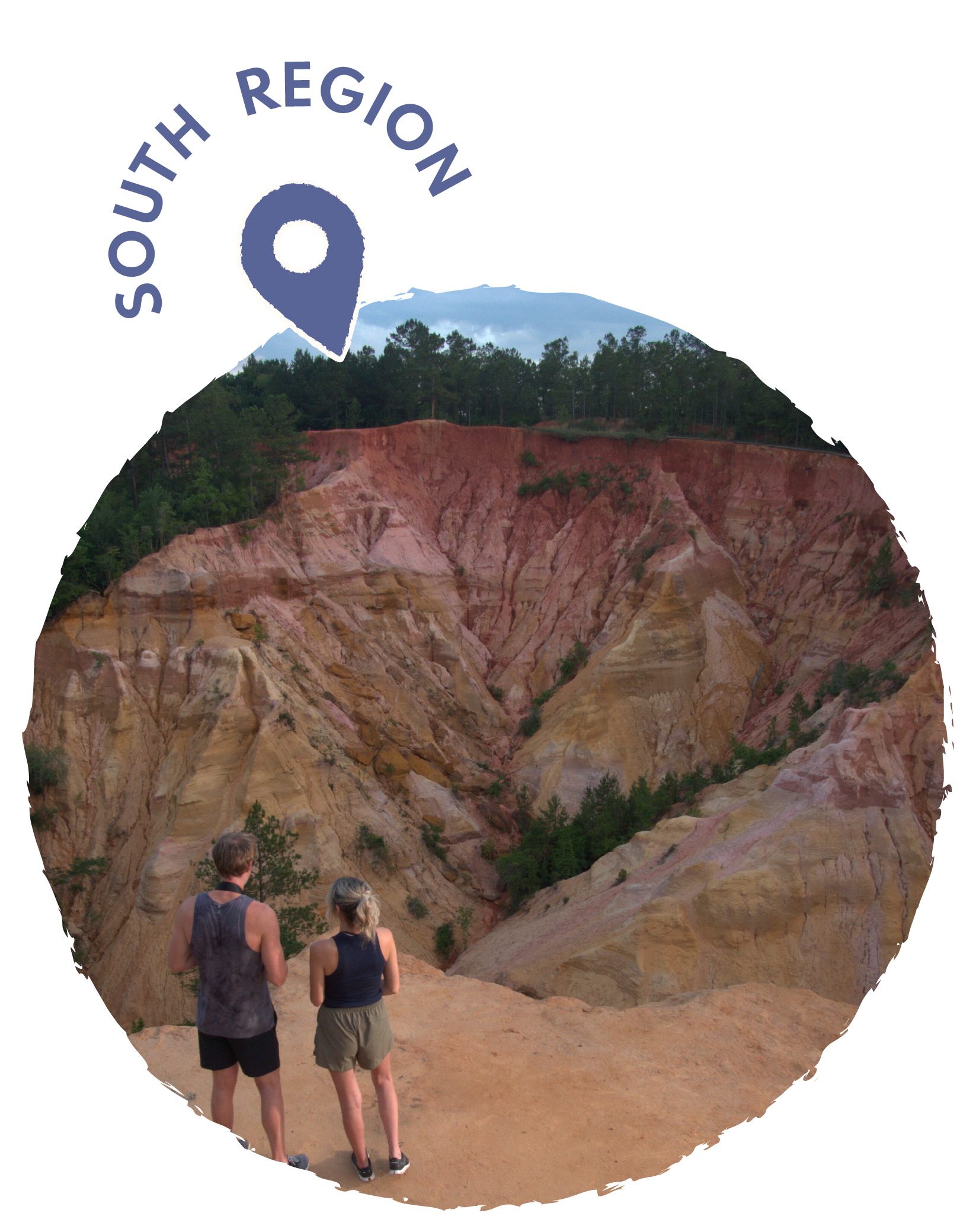
Red Bluff, located in Foxworth in Marion County, Mississippi, is a breathtaking geological formation commonly known as "Mississippi's Little Grand Canyon". This natural feature was created by the natural erosion of the west bank of the Pearl River, resulting in an exposure of red clay, soil, sand, and other colorful sediments that rises to an elevation of approximately 371 feet above sea level. The formation boasts vivid red and orange hues and features a nearly one-mile moderately challenging loop trail that takes an average of 30 minutes to complete. The bluff slopes sharply (200 feet) into the Pearl River floodplain, and the ongoing natural erosion process has forced the movement of nearby Mississippi Highway 587 at least two times. Visitors can access the Pearl River from the trail and cool off in its refreshing waters after hiking. Red Bluff is situated along Highway 587 in Marion County, just northwest of the community of Morgantown, though finding it can be challenging as it is not a state park nor a protected or maintained area, meaning it has no hours of operation, no gates, and no designated trails. The soil at Red Bluff is notorious for staining clothes with bright orange discoloration, so visitors should wear appropriate hiking attire. The view from the bluff encompasses a significant portion of the Pearl River Basin in Marion County, as well as the eastern portion of the nearby city of Columbia, Mississippi.
GPS COORDINATES: 31°19′32″N 89°56′45″W

-
Clark Creek Natural Area is a publicly owned, natural preservation area encompassing 700 acres off Mississippi Highway 24 approximately 13 miles west of Woodville, Mississippi. The state park features approximately 50 waterfalls, some with up to 30-foot drops. The park was established in 1978 through the efforts of the Mississippi Wildlife Heritage Committee, the Nature Conservancy, Wilkinson County, David Bramlette, International Paper Company and the Mississippi Department of Wildlife, Fisheries and Parks. The nature area has a mix of hardwood and pine forest with large beech and magnolia trees, along with several uncommon trees that can be seen including Southern sugar maple, serviceberry, umbrella tree, pyramid magnolia, chinquapin oak and witch-hazel. The park offers both primitive and improved trails, the primitive trail is approximately 2.6 miles and usually takes 3–5 hours to complete while the improved trails are approximately 1.75 miles long and usually take around 2 hours to complete. Hiking is not easy by any means but is challenging at an intermediate level, with steep terrain and creek crossings that make it a popular destination for outdoor enthusiasts seeking waterfall views and wildlife observation.
GPS COORDINATES: 31.0718° N -91.5115° W
-
Clarkco State Park, a beloved Mississippi recreation destination since 1938, sits on 815 acres of gently rolling woodlands near Quitman, just south of Meridian close to the Mississippi-Alabama state line. Originally established by the Civilian Conservation Corps (CCC), the park centers around the scenic 65-acre Ivy Lake, which offers excellent freshwater fishing for bass, bream, and catfish, as well as boating, water skiing, and tubing opportunities. The park features 20 air-conditioned lakefront cabins that can accommodate two to eight guests, each with private piers and stunning lake views, plus one cottage and both developed and primitive camping sites. Outdoor enthusiasts can explore 14 miles of well-maintained nature and mountain biking trails, including a five-mile nature trail that encircles the park and offers close encounters with Mississippi's diverse flora and fauna. Additional amenities include 60 picnic sites with grills and tables, three large pavilions perfect for group events, tennis courts with pickleball lines, a disc golf course, playgrounds, and a splash pad. The park also features an outdoor amphitheater overlooking Inspiration Point, which serves as a popular wedding venue, and an observation tower at the upper end of the lake. Whether visitors seek a peaceful weekend retreat or an action-packed family adventure, Clarkco State Park provides the perfect blend of natural beauty and recreational activities in a convenient yet unspoiled setting.
GPS COORDINATES: 32.227° N, 88.632° W
-
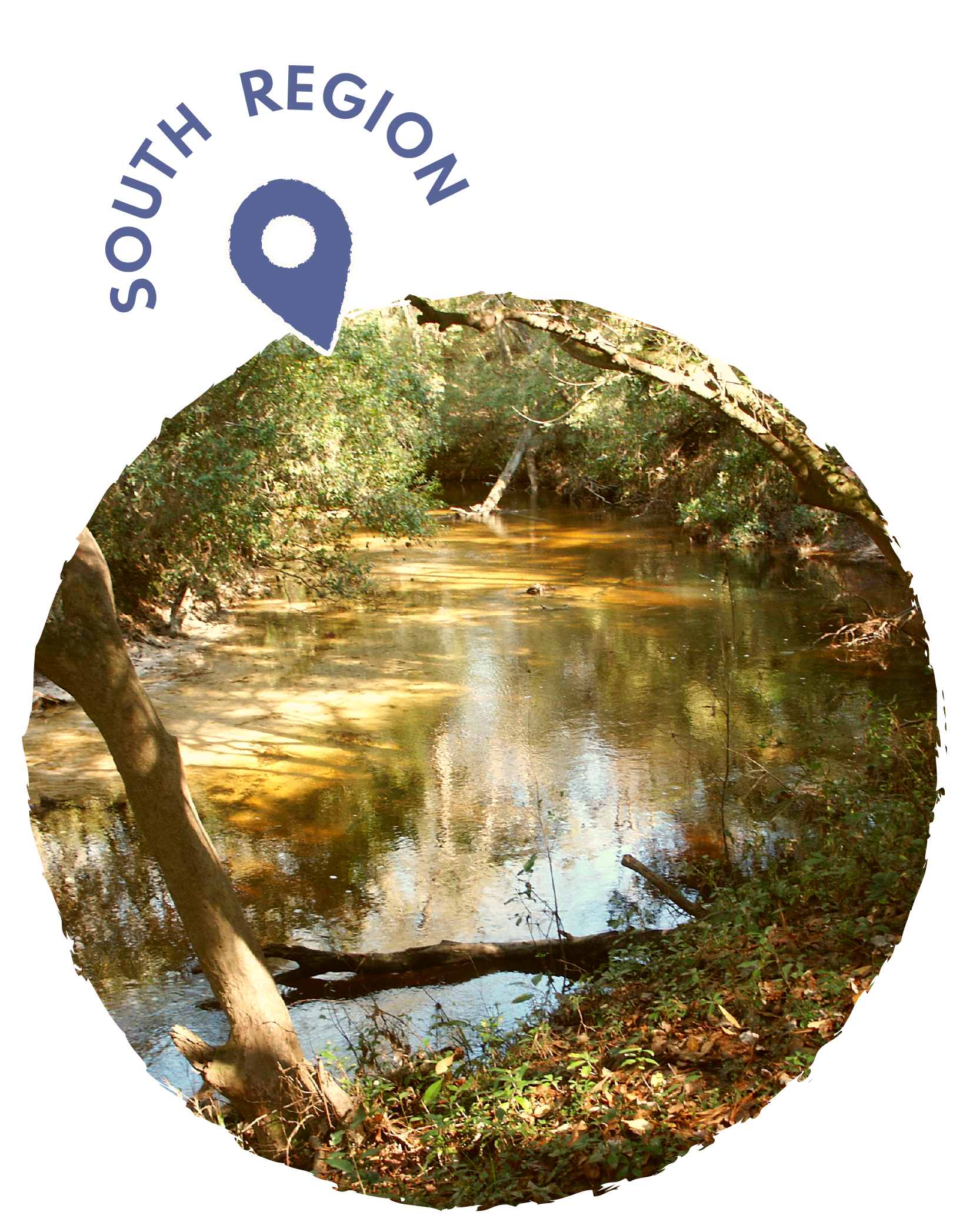
Black Creek National Wild and Scenic River in Mississippi is the state's first and only designated wild and scenic river, having been included in the National Wild and Scenic Rivers System by Congress in 1986. This scenic southern waterway features deep, black water, colorful vertical bluffs, and contrasting white sand bars as it follows a meandering course through Mississippi's coastal plain. The 21-mile designated segment stretches from Fairley Bridge Landing upstream to Moody's Landing, flowing through the De Soto National Forest where plants flourish and wildlife abounds. Trees and flowering shrubs overhang the banks, and visitors often spot wood ducks and otters along the stream. The river provides excellent opportunities for fishing, canoeing, backpacking, and primitive camping, with six launch points available for paddlers. The Black Creek watershed supports remarkable biodiversity, containing over 130 fish species and serving as habitat for the federally threatened pearl darter and possibly the gulf sturgeon. The river has significant historical importance, having served indigenous populations for over 11,000 years and later being used by European settlers and as a log transportation route after the Civil War. The creek flows through the Black Creek Wilderness, Mississippi's largest wilderness area at 5,052 acres, creating important coastal plain ecosystems with longleaf pine forests and bottomland hardwoods.
GPS COORDINATES: 30°58′47″N 089°01′41″W

-
Gulf Islands National Seashore stretches along the Gulf of America coast, encompassing pristine barrier islands and mainland areas across Mississippi and Florida. In Mississippi, the seashore includes pristine sections of coastline near Ocean Springs and Biloxi, offering visitors access to white sand beaches, historic fortifications, and diverse coastal ecosystems. The park protects critical habitat for migratory birds, sea turtles, and other wildlife while preserving important Civil War-era structures like Fort Massachusetts on Ship Island. Visitors can enjoy swimming, fishing, boating, and camping, with ferry services providing access to the offshore islands during operating season. The seashore's crystal-clear waters and undeveloped beaches provide a stark contrast to the more commercialized coastal areas nearby. Historic Fort Massachusetts, built in the 1850s, offers guided tours and educational programs about the area's military significance during the Civil War. The park also features excellent opportunities for kayaking through calm coastal waters and observing dolphins, pelicans, and other marine life in their natural habitat. Camping facilities on the mainland provide convenient access to both the beaches and the charming historic downtown areas of Ocean Springs and nearby communities.
GPS COORDINATES: 30.37°N -86.91°W
-
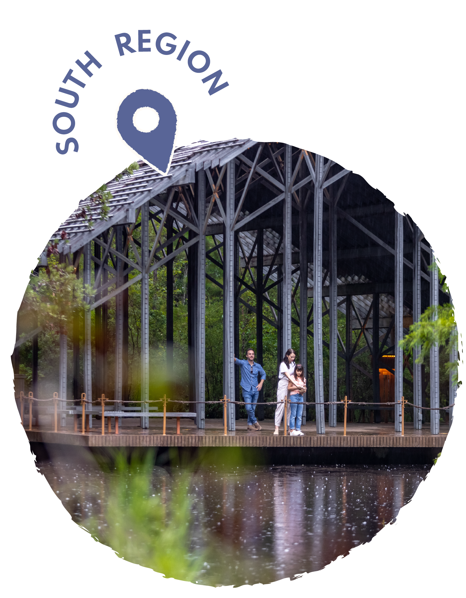
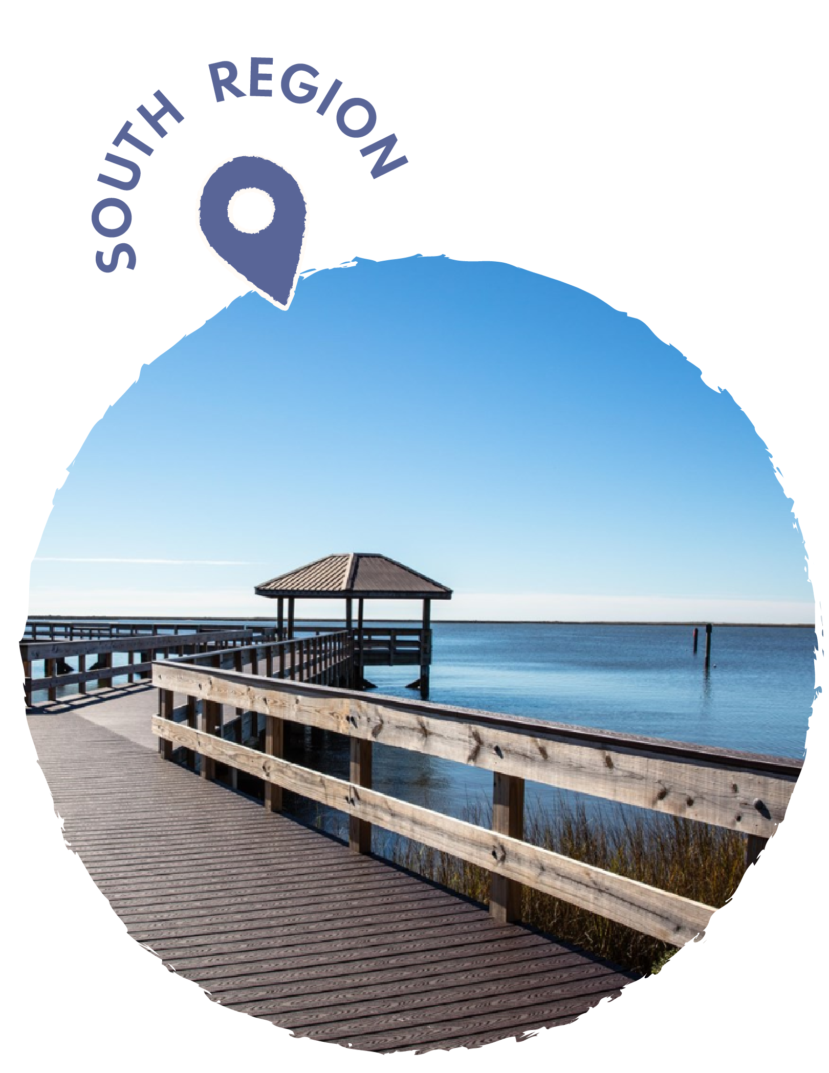
The Davis Bayou Area, located in Ocean Springs, Mississippi within the Gulf Islands National Seashore, is a serene coastal environment known for its winding salt-marsh bayous, moss-draped oak and pine forests, and abundant wildlife. Visitors can explore short scenic trails, paddle through the bayous on the protected blueway, or fish from the designated pier near the visitor center. The William M. Colmer Visitor Center offers exhibits, ranger programs, and a great introduction to the area’s ecology, while nearby shaded picnic spots provide relaxing places to enjoy the surroundings. A quiet, well-kept campground with hookups and modern facilities makes it a comfortable base for exploring the marshes and waterways. With opportunities for birdwatching, photography, easy hiking, and peaceful paddling, Davis Bayou offers a calm, nature-rich getaway on Mississippi’s Gulf Coast.
GPS COORDINATES: 30° 23' 52.1599" N 88° 47' 43.8698" W